You open Google Maps, tap a destination, and a blue dot appears exactly where you are, within a few metres, anywhere on Earth. You’ve probably done this hundreds of times. But have you ever stopped to wonder what’s actually happening behind the screen?
GPS is one of the most remarkable engineering systems humans have ever built. And once you understand how it works, you’ll see why it’s become the backbone of everything from smartphone navigation to fleet tracking to India’s national security infrastructure.
What Is GPS?
GPS stands for Global Positioning System. It was built by the United States Department of Defense in the 1970s, originally for military use. It was opened to the public in the 1980s, and since then it has become a technology most of us rely on every single day without thinking about it.
At its core, GPS answers one simple question: Where am I?
It does this using satellites, dozens of them, orbiting far above the Earth.
The Satellites
The GPS network consists of at least 24 operational satellites (the US government currently maintains 31) orbiting approximately 20,200 kilometres above the Earth’s surface. That’s roughly 53 times the cruising altitude of a commercial aircraft.
These satellites are arranged so that at any given moment, from any point on Earth, you have a clear line of sight to at least four of them.
Each satellite does two things continuously:
- Broadcasts its exact position in space
- Broadcasts the precise time of transmission, using an atomic clock accurate to within a nanosecond
Your GPS receiver (in your phone, your car, your vehicle tracker) picks up these signals. It doesn’t send anything back. GPS is entirely one-way. The satellites broadcast, and receivers listen.
How Your Location Is Calculated: Trilateration
Here’s where the clever part comes in.
Radio signals travel at the speed of light, approximately 300,000 kilometres per second. When your receiver gets a signal from a satellite, it compares the satellite’s timestamp to its own clock. The tiny difference in time tells it exactly how far away that satellite is.
Distance = Speed of Light × Time Difference
Now imagine a single satellite tells your receiver: “You are exactly 20,000 km from me.”
That means you could be anywhere on a sphere 20,000 km from that satellite. Not very helpful.
Add a second satellite: “You are 21,500 km from me.”
Now you’re at the intersection of two spheres, which is a circle. Better, but still not a single point.
Add a third satellite: the two possible intersection points are reduced to just two locations. One of them is usually in outer space or underground, so the receiver eliminates it. You’re left with a single point on Earth’s surface.
A fourth satellite does two things. It gives your receiver an accurate altitude reading, and it corrects for tiny errors in the receiver’s own clock. Receiver clocks aren’t as precise as atomic clocks, and even a microsecond of error translates to 300 metres of position error.
This process is called trilateration. It’s not the same as triangulation (which uses angles). Trilateration uses distances, and it happens in your device dozens of times per second.
How Accurate Is GPS?
Under normal conditions, consumer GPS is accurate to about 3 to 5 metres. This is good enough for navigation, but in the real world several things can introduce error:
- Urban canyons: tall buildings can block or reflect signals, causing multipath errors
- Atmospheric interference: signals slow slightly as they pass through the ionosphere and troposphere
- Satellite geometry: if the satellites in view are all bunched together in one part of the sky rather than spread out, accuracy drops
- Receiver quality: the chip inside a cheap tracker behaves very differently from a precision surveying instrument
For most everyday and commercial uses, 3 to 5 metres is more than adequate. For fleet tracking purposes, knowing that a vehicle is on a particular road, at a particular junction, at a particular time is exactly what’s needed.
GPS and India: Where NavIC Comes In
India does not rely solely on the American GPS system. In 2016, the Indian Space Research Organisation (ISRO) launched NavIC (Navigation with Indian Constellation), India’s own regional navigation satellite system.
NavIC uses 7 satellites positioned specifically to provide coverage over India and surrounding regions up to 1,500 km beyond its borders. It offers accuracy of better than 5 metres over the Indian subcontinent, which in some conditions outperforms standard GPS.
Why does India have its own system? During the Kargil War in 1999, India requested GPS data from the United States and was refused. That incident made it clear that depending entirely on another country’s navigation infrastructure was a strategic vulnerability. NavIC was the answer.
Today, NavIC is integrated into India’s AIS 140 vehicle tracking standard, the government mandate that requires public service vehicles, commercial transport, and school buses to carry certified GPS tracking devices. AIS 140 certified devices must support NavIC alongside GPS, ensuring that fleet tracking in India works on Indian infrastructure.
So How Does GPS Actually Track a Vehicle?
This is where many people get confused. GPS satellites don’t know your vehicle exists. They don’t “track” you. They just broadcast signals.
Here’s the full picture for a GPS-tracked vehicle:
- The GPS device (installed in the vehicle) receives signals from multiple satellites and calculates the vehicle’s position, speed, and direction
- The device sends this data via a SIM card over a mobile network (GPRS or 4G) to a server
- The server processes and stores the location data
- You (or a fleet manager) log into a web dashboard or app and see the vehicle’s real-time position, trip history, speed, stops, and alerts
The satellites are just one part of the chain. The mobile network, the device hardware, the server software, and the user interface all have to work together. This is why the quality of a GPS tracking solution depends on much more than just satellite count.
What GPS Cannot Do
A few things GPS cannot do, because there are common misconceptions:
- GPS cannot track people without a device. You need a physical GPS receiver on or with the person or object you want to track.
- GPS does not work well indoors. Satellite signals are weak and can be blocked by roofs and walls. Indoor positioning relies on Wi-Fi, Bluetooth beacons, or cellular triangulation instead.
- GPS does not tell you who is driving. It tells you where a vehicle is. Driver identification requires additional systems like RFID cards, PIN entry, or driver behaviour analysis.
- GPS data alone is not surveillance. For commercial fleet tracking, the purpose is operational: fuel management, route efficiency, safety, and compliance. How that data is collected and used is governed by India’s Digital Personal Data Protection (DPDP) Act 2023.
From Space to Dashboard: The Complete Picture
It’s remarkable when you think about it. A signal leaves a satellite 20,000 km above Earth, travels at the speed of light, arrives at a small device mounted behind a vehicle’s dashboard, gets combined with three other signals from three other satellites, gets converted into a precise coordinate, gets sent over a mobile network, gets processed by a server, and appears on your screen as a dot on a map. All in under a second.
GPS is invisible infrastructure. Like electricity or running water, you only notice it when it’s not there.
For businesses running fleets in India, whether logistics companies, school bus operators, or construction firms, GPS tracking isn’t just a convenience. It’s the foundation of compliance (AIS 140), safety (panic buttons, speed alerts), and efficiency (route optimisation, fuel monitoring).
Understanding how it works is the first step to using it well.
Frequently Asked Questions
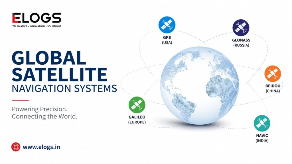
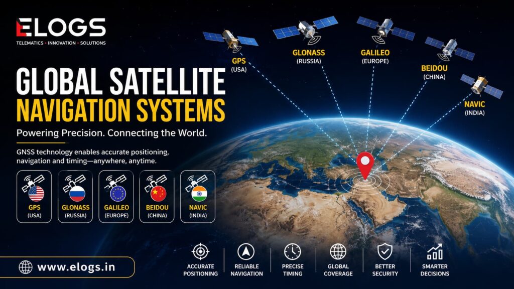
How many GPS satellites are there? The US GPS constellation maintains 31 operational satellites, of which at least 24 are always active. Other countries operate their own systems: Russia’s GLONASS, Europe’s Galileo, China’s BeiDou, and India’s NavIC.
Does GPS work without internet? The GPS receiver itself doesn’t need internet. It receives satellite signals directly. But to show your location on a map, or to send fleet tracking data to a server, an internet or mobile connection is required.
Why does GPS sometimes show the wrong location? Signal reflections off buildings (multipath), poor satellite geometry, atmospheric interference, or a device that has just powered on and hasn’t yet locked onto enough satellites can all cause temporary inaccuracy. Most devices correct within a few seconds of getting a clear sky view.
Is GPS the same as vehicle tracking? GPS is the positioning technology. Vehicle tracking is a complete system that includes GPS, a mobile connection, a server, and a user interface. GPS is one component of a tracking solution.
Does GPS drain the battery? The GPS receiver chip itself uses relatively little power. In smartphones, the bigger drain is the screen and the mobile data connection used to load maps. Dedicated vehicle trackers are wired to the vehicle’s power supply and don’t have this concern.
elogs.in provides AIS 140 certified GPS tracking devices and fleet management software for businesses across India.Get in touch to find out how GPS tracking can work for your fleet.